ISEED
Statewide Integration of CI-Visualization for EPSCoR MILES

Principal Investigators
Idaho State University: Donna Delparte and Rob Edsall
Boise State University: Nancy Glenn and Steve Cutchin
University of Idaho: Luke Sheneman, Bruce Godfrey, and Tim Frazier
Project Summary
The purpose of this project is to kick-start a highly innovative, creative and cross-institutional investigation into effective Visualization strategies for ecosystem services in Idaho. This endeavor will create a statewide visualization working group with participants from all three institutions and interested stakeholders and partners. Our emphasis is on developing intuitive 3D visual interfaces to enable researchers, stakeholders and the public to interactively view modeling products emerging from the MILES program.
If you are part of this project and looking for the Data/Tool Catalog or Documentation pages, please login to the previous version of this website.
The following virtualizations, developed for the CI-Viz ISEED award, use ESRI's CityEngine.
Click on an image to launch the application.
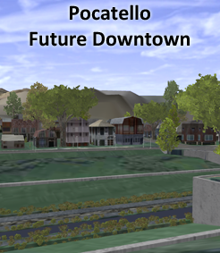
Future Pocatello ISEED
Meg Tracy, Idaho State Univ
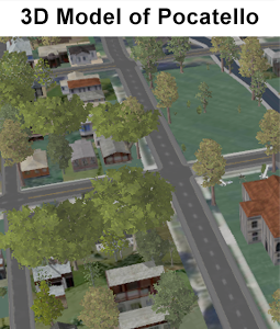
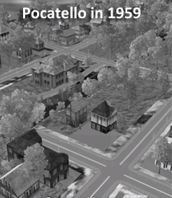
Compare the previous 2 images of Pocatello, one current and one from 1959 with this one showing a possible future.
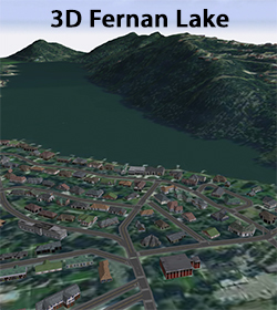
3-D Fernan Lake ISEED
Kevin Henry, Univ of Idaho
This 3D visualization of Fernan Lake Village, Idaho and surrounding area demonstrates the capabilities of ESRI's CityEngine for use in SES research and communication. Analysis products such as wildfire severity and lake sensitivity analyses can be viewed in conjunction with infrastructure and development derived from existing GIS data.
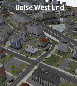
Boise West End ISEED
Josh Johnston, Boise State Univ
A CityEngine web scene of Boise's West End along the Connector, Main, and Idaho streets. Density of development is shown at three levels.